Southwest Monsoon Set to Advance Over Andaman & Nicobar Islands Around May 16; Severe Heat Wave Looms Over Northwest and Central India
The India Meteorological Department (IMD) has announced that conditions are favourable for the advance of the southwest monsoon over parts of the south Bay of Bengal, Andaman Sea, and Andaman & Nicobar Islands around May 16, 2026. While this marks the initial phase of the crucial seasonal rainfall, large parts of northwest and central India are bracing for intense heat wave to severe heat wave conditions over the coming week, even as scattered heavy to very heavy rainfall is expected in the northeast and southern peninsular regions.
In the past 24 hours, the country witnessed a mix of extreme weather. Heavy rainfall (7-11 cm) was recorded at isolated places over Odisha, Meghalaya, and North Interior Karnataka, with very heavy rainfall in Sub-Himalayan West Bengal & Sikkim. Significant amounts included Majhian in Sub-Himalayan West Bengal recording 12 cm, Banki in Odisha 10 cm, and Menang in Assam & Meghalaya 9 cm.
Thunderstorms accompanied by squally or gusty winds lashed several regions, with wind speeds reaching 50-130 kmph at isolated places across Madhya Maharashtra, East and West Uttar Pradesh, Nagaland, Manipur, Mizoram, Tripura, Uttarakhand, Jharkhand, Bihar, Jammu-Kashmir-Ladakh, Haryana, Chandigarh, Delhi, Punjab, Odisha, Saurashtra-Kutch, Andaman & Nicobar Islands, Chhattisgarh, Marathwada, East Madhya Pradesh, North Interior Karnataka, and Kerala & Mahe. Particularly strong gusts were noted in East Uttar Pradesh (Dograi 130 kmph) and West Uttar Pradesh (G-Chullhara, Bareilly 130 kmph). Hailstorms were also reported at isolated places in Jammu-Kashmir-Ladakh, Uttarakhand, Uttar Pradesh, West Rajasthan, Punjab, Haryana & Delhi, East Madhya Pradesh, and parts of Maharashtra.
Heat wave to severe heat wave conditions prevailed in isolated pockets over Saurashtra & Kutch, with heat wave conditions in Vidarbha, West Rajasthan, East Rajasthan, Madhya Maharashtra, Marathwada, and West Madhya Pradesh. The highest maximum temperature recorded yesterday was 46.1°C at Jaisalmer in Rajasthan. Many parts of Rajasthan, Gujarat, Marathwada, Vidarbha, and West Madhya Pradesh saw temperatures of 42°C and above.
Temperature Trends and Departures
Maximum temperatures were markedly above normal over parts of West Madhya Pradesh and isolated areas of East Madhya Pradesh and Saurashtra & Kutch. Appreciably above normal departures were observed over West Rajasthan and several other regions. Minimum temperatures were also appreciably above normal over West Rajasthan, Gujarat Region, Maharashtra, and Madhya Pradesh, indicating warm nights in some pockets.
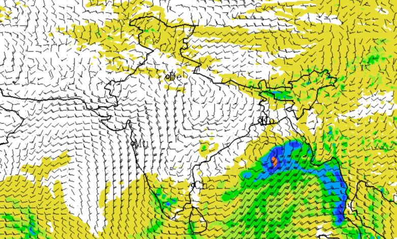
Weather Systems Driving the Forecast
A well-marked low-pressure area persists over the southwest and adjoining west-central Bay of Bengal, with an associated cyclonic circulation extending up to 5.8 km. Upper air cyclonic circulations are present over West Uttar Pradesh, East Uttar Pradesh, North Interior Karnataka, southeast Madhya Pradesh, and east Bangladesh. An east-west trough runs from southeast Madhya Pradesh to Sub-Himalayan West Bengal & Sikkim. A fresh feeble Western Disturbance is expected to affect Northwest India from May 15.
Regional Outlook
- Northwest India: Isolated light to moderate rainfall with thunderstorms and gusty winds (40-50 kmph) is likely over Himachal Pradesh, Uttarakhand, Punjab, Haryana, Chandigarh, Rajasthan, and Uttar Pradesh in the next couple of days. A gradual rise in maximum temperatures by 3-5°C is expected till May 17.
- Northeast India: Scattered to fairly widespread rainfall with thunderstorms is forecast. Isolated heavy to very heavy rainfall is likely over Arunachal Pradesh, Assam & Meghalaya, Nagaland, Manipur, and Mizoram during the coming days, with very heavy spells possible on specific dates.
- East India: Widespread light to moderate rainfall with thunderstorms and thundersqualls (50-60 kmph gusting to 70 kmph) expected over Sub-Himalayan West Bengal & Sikkim, Bihar, Jharkhand, and Odisha. Isolated very heavy rainfall is possible over Andaman & Nicobar Islands and Sub-Himalayan West Bengal & Sikkim around May 16-17.
- Central and West India: Isolated rainfall and thunderstorms over East Madhya Pradesh, Vidarbha, Chhattisgarh, Konkan & Goa, Madhya Maharashtra, and Marathwada. Heat wave conditions will dominate.
- South Peninsular India: Scattered thunderstorms with gusty winds over Kerala & Mahe, Interior Karnataka, Rayalaseema, and Coastal Andhra Pradesh. Isolated heavy rainfall is likely over Tamil Nadu, Puducherry & Karaikal, Kerala & Mahe, and South Interior Karnataka in the next 4-5 days. Hailstorms are possible over parts of Karnataka.
Persistent Heat Wave Threat
Heat wave conditions are expected at many places with severe heat wave in isolated pockets, particularly over West Rajasthan (May 17-19), Punjab, Haryana, Delhi, Uttar Pradesh, Madhya Pradesh, Vidarbha, Chhattisgarh, and parts of Maharashtra and Gujarat. Warm night conditions are also likely in some areas. The public is advised to avoid prolonged exposure to the sun, stay hydrated, and use ORS or homemade electrolyte drinks. Vulnerable groups such as infants, the elderly, and those with chronic illnesses face higher risks.
Fishermen Advisory
Fishermen have been warned not to venture into large parts of the Bay of Bengal, including the Gulf of Mannar, Comorin area, south Bay of Bengal, Andaman Sea, and areas off Myanmar coast from May 14 to 19. Restrictions also apply along the Kerala coast and Lakshadweep in the Arabian Sea.
Delhi/NCR Forecast
In Delhi, partly cloudy skies with a spell of very light to light rain, thunderstorms, and strong winds (40-50 kmph gusting to 60 kmph) are likely on May 14 evening/night. Maximum temperatures are expected to hover between 39-42°C over the next few days, with minimums in the 23-26°C range. Winds will predominantly be from northwest to west directions.
Impacts and Safety Measures
Strong winds and hail may damage crops, trees, power lines, and vulnerable structures. Heavy rainfall could trigger localized flooding, waterlogging, traffic disruptions, and landslides in hilly areas. Farmers are advised to ensure proper drainage, support tall crops, harvest mature produce early, and use hail nets where necessary. Livestock should be sheltered, and adequate drinking water provided during heat waves.
The IMD has urged residents to stay updated through official channels and take necessary precautions. As the lead period increases, forecast accuracy may vary. For detailed district-wise warnings, refer to the IMD website.
This mixed weather pattern—early monsoon signals in the south and east alongside blistering heat in the north and west—highlights the diverse climatic challenges facing India in mid-May 2026.