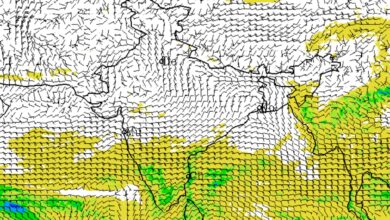
Deep Depression Triggers Extremely Heavy Rain in Odisha; Balasore Records 247 mm, IMD Reports Widespread Downpour Across State

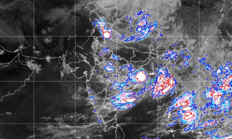
The Deep Depression that crossed the West Bengal-Odisha coast near Digha unleashed torrential rainfall across Odisha, with several districts recording extremely heavy to very heavy rainfall during the 24-hour period ending at 8:30 AM IST on July 28, 2026. According to India Meteorological Department (IMD) data, Balasore district emerged as the worst-hit, with Balasore station recording 246.6 mm of rainfall, while Nilgiri received 239 mm and Remuna 222 mm.
The widespread rainfall affected large parts of northern and coastal Odisha, with heavy showers also reported from Mayurbhanj, Keonjhar, Sundargarh, Bhadrak, Kendrapara, Puri, Sambalpur, Jajpur, Jagatsinghpur and Deogarh. The intense rainfall followed the landfall of the Deep Depression, which is now moving inland towards Jharkhand and Chhattisgarh.
Highest Rainfall Recorded in Odisha
| Rank | Station | District | Rainfall (mm) |
|---|---|---|---|
| 1 | Balasore | Balasore | 246.6 |
| 2 | Nilgiri | Balasore | 239.0 |
| 3 | Remuna | Balasore | 222.0 |
| 4 | Betanati | Mayurbhanj | 202.0 |
| 5 | Jaleswar | Balasore | 162.0 |
| 6 | Hatadihi | Keonjhar | 160.3 |
| 7 | Gurundia | Sundargarh | 159.0 |
| 8 | G.B. Nagar | Mayurbhanj | 158.0 |
| 9 | Dhamnagar | Bhadrak | 155.0 |
| 10 | Udala | Mayurbhanj | 154.3 |
The IMD data also showed rainfall exceeding 140 mm at Bhadrak (148 mm), Shamakhunta (148 mm), Banaigarh (137 mm), Tensa (136.2 mm) and Lathikata (135 mm), highlighting the widespread nature of the heavy rainfall event.
Rainfall Spread Across Odisha
The rainfall analysis indicates that 94% of all observation stations across Odisha received rainfall during the period, reflecting the extensive impact of the weather system.
| Region | Stations Reporting Rainfall |
|---|---|
| North Coastal Odisha | 100% (54/54) |
| North Interior Odisha | 100% (94/94) |
| South Coastal Odisha | 66% (33/50) |
| South Interior Odisha | 100% (86/86) |
| Coastal Odisha | 84% (87/104) |
| Interior Odisha | 100% (180/180) |
| North Odisha | 100% (148/148) |
| South Odisha | 88% (119/136) |
| Entire Odisha | 94% (267/284 stations) |
According to the IMD’s rainfall classification, the state recorded:
| Rainfall Category | Number of Stations |
|---|---|
| Extremely Heavy Rainfall | 3 |
| Very Heavy Rainfall | 21 |
| Heavy Rainfall | 54 |
Most of the extremely heavy rainfall stations were located in North Coastal Odisha, while widespread heavy rainfall was observed across the northern districts.
Northern Odisha Worst Affected
The heaviest rainfall was concentrated over Balasore, Mayurbhanj, Keonjhar, Bhadrak and Sundargarh, with several stations receiving more than 150 mm of rainfall in just 24 hours.
Other notable rainfall totals included:
- Puri – 121 mm
- Kendrapara (Rajnagar) – 122 mm
- Sambalpur – 120.6 mm
- Baripada – 119 mm
- Soro – 117 mm
- Hirakud – 114.6 mm
- Bhograi – 129 mm
- Kaptipada – 129 mm
The widespread rainfall has increased the risk of waterlogging, localized flooding, overflowing drains and disruption to road traffic, particularly in low-lying areas.
Himachal Pradesh Also Receives Heavy Rain
Meanwhile, Himachal Pradesh also witnessed significant rainfall during the same 24-hour period.
The highest rainfall in the state was recorded at Jot in Chamba district with 137.8 mm, followed by Naina Devi (Bilaspur) with 118 mm and Murari Devi (Mandi) with 83 mm.
Highest Rainfall in Himachal Pradesh
| Station | District | Rainfall (mm) |
|---|---|---|
| Jot | Chamba | 137.8 |
| Naina Devi | Bilaspur | 118.0 |
| Murari Devi | Mandi | 83.0 |
| Ghamroor | Kangra | 58.2 |
| Shimla | Shimla | 58.2 |
| Brahmani | Bilaspur | 54.6 |
| Jogindernagar | Mandi | 52.0 |
| Malraon | Bilaspur | 47.0 |
| Olinda | Bilaspur | 44.0 |
| Hamirpur AWS | Hamirpur | 43.0 |
| RL BBMB | Bilaspur | 42.4 |
| Nagrota Suriyan | Kangra | 42.2 |
The IMD has warned that the Deep Depression will continue moving inland, maintaining the likelihood of heavy rainfall across eastern and central India over the next 24 to 48 hours, while authorities remain on alert for localized flooding and rain-related disruptions.