IMD Issues Alert for Widespread Rainfall, Thunderstorms, and Gusty Winds Across Northeast India and Sub-Himalayan Regions
The India Meteorological Department (IMD) has forecast fairly widespread to widespread rainfall accompanied by thunderstorms, lightning, and gusty winds over Sub-Himalayan West Bengal & Sikkim and Northeast India during the coming week. Isolated extremely heavy rainfall is likely over Assam & Meghalaya and Sub-Himalayan West Bengal & Sikkim today, April 29.
In the past 24 hours ending at 0830 hours IST today, heavy to very heavy rainfall occurred at some places over Sub-Himalayan West Bengal & Sikkim, with extremely heavy rainfall (≥21 cm) recorded at isolated locations. Heavy to very heavy rainfall (7-20 cm) lashed many places in Tripura, while heavy rainfall (7-11 cm) fell at a few places in Assam. Significant amounts included 20 cm at Hilla T.E. in Jalpaiguri, 18 cm at Jiti T.E., and 12 cm each at Chalouni and Kurti Tea Estates. In Tripura, Sonamura recorded 12 cm and Gandachara 10 cm. Assam saw 9 cm at Goalpara PTO and 8 cm at Dhupdhara.
Thunderstorms with squally or gusty winds swept isolated areas across multiple regions. Winds reached 50-100 kmph in parts of Arunachal Pradesh, Assam & Meghalaya, Nagaland, Manipur, Mizoram & Tripura, Odisha, Jammu-Kashmir-Ladakh-Gilgit-Baltistan-Muzaffarabad, Punjab, Haryana, West Uttar Pradesh, Madhya Pradesh, Saurashtra & Kutch, and Tamil Nadu, Puducherry & Karaikal. Notable gusts included 91 kmph at Teliamura_Barragr in Tripura, 89 kmph at Hezamara, 83 kmph at Dwarka in Saurashtra, 74 kmph squall at Agartala, 72 kmph at Benakuda in Odisha, and 68 kmph at Manas in Assam. Lighter gusts of 30-50 kmph affected West Bengal, Vidarbha, Chhattisgarh, Maharashtra, and Gujarat Region. Hailstorms were reported over Uttarakhand, Odisha, Interior Karnataka, and Telangana.
While the eastern and northeastern parts experienced wet and stormy weather, heatwave conditions persisted in isolated pockets of East Uttar Pradesh, Vidarbha, and Odisha. The highest maximum temperature reached 45.6°C at Banda in Uttar Pradesh. Daytime temperatures ranged between 40-46°C over most of the country, except in the western Himalayan region and Northeast India where they stayed below 36°C. Many places recorded appreciably above-normal maximum temperatures, particularly in East Madhya Pradesh, East Uttar Pradesh, Odisha, and parts of Kerala, Konkan & Goa, and Saurashtra & Kutch.
Minimum temperatures remained in the 13–19°C range over Jammu-Kashmir-Ladakh-Gilgit-Baltistan-Muzaffarabad, Himachal Pradesh, Uttarakhand, Sikkim, Northeast states, and Tamil Nadu. They were appreciably above normal in Meghalaya and Odisha.
Weather Systems Driving the Activity
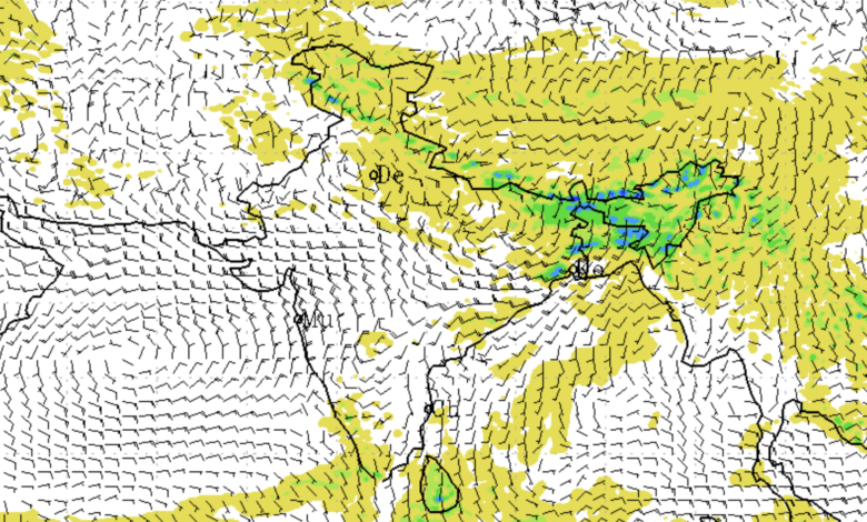
Several weather systems are influencing the current spell. A Western Disturbance appears as a cyclonic circulation over north Pakistan and adjoining Kashmir. An induced upper air cyclonic circulation lies over Punjab and neighbourhood, with another over southwest Rajasthan. Additional cyclonic circulations are positioned over southeast Uttar Pradesh and northeast Bangladesh. Key troughs include a north-south trough from north Punjab to southwest Rajasthan and an east-west trough extending from southeast Uttar Pradesh to Nagaland. A trough also runs from northeast Madhya Pradesh to northeast Bangladesh. These systems are triggering widespread convective activity, especially in the east and northeast.
A fresh Western Disturbance is expected to affect the Western Himalayan Region from May 2.
Regional Forecasts
Northeast India: Fairly widespread to widespread light to moderate rainfall with thunderstorms, lightning, and gusty winds (30-50 kmph) is likely over the next five days. Thundersqualls (50-60 kmph, gusting to 70 kmph) are expected over Nagaland, Manipur, Mizoram & Tripura on April 29 and 30. Isolated extremely heavy rainfall is probable over Assam & Meghalaya today, with isolated heavy rainfall likely across the region through early May and isolated very heavy falls in several sub-divisions between April 30 and May 3.
East India: Similar widespread rainfall activity is forecast over Sub-Himalayan West Bengal & Sikkim from April 29 to May 3, and over Gangetic West Bengal until May 5. Thundersqualls are likely over Gangetic West Bengal, Bihar, Jharkhand, and Odisha on April 29 and 30. Isolated extremely heavy rain is expected over Sub-Himalayan West Bengal & Sikkim today, with isolated heavy to very heavy falls possible in the coming days. Isolated hailstorms may occur over Odisha today and Jharkhand tomorrow.
Northwest India: Scattered to fairly widespread light to moderate rainfall/snowfall with thunderstorms and gusty winds (40-50 kmph) is likely over Jammu & Kashmir today and again from May 3-5, Himachal Pradesh today and on May 3-4, and Uttarakhand through May 5. Isolated to scattered rain with thunderstorms is expected over Punjab, Haryana, Chandigarh & Delhi, Uttar Pradesh, and Rajasthan in phases. Duststorms are very likely over Uttar Pradesh today and West Rajasthan from May 2-4. Thundersqualls and isolated hailstorms are possible in parts of Uttar Pradesh, Himachal Pradesh, and Uttarakhand today.
Central and South India: Isolated light to moderate rainfall with thunderstorms and gusty winds is likely over Madhya Pradesh, Chhattisgarh, and Vidarbha in phases. In South Peninsular India, isolated to scattered rainfall with thunderstorms is forecast over Tamil Nadu, Kerala, Coastal Andhra Pradesh, Telangana, and parts of Karnataka through early May. Heavy rainfall is likely over Kerala & Mahe from April 29 to May 2, South Interior Karnataka today and tomorrow, and Tamil Nadu from April 30 to May 2. Isolated hailstorms may hit Telangana today and Interior Karnataka on April 29-30.
Temperature Outlook and Heat Concerns
No major change in maximum temperatures is expected over most parts in the immediate term, with gradual falls of 2-5°C likely over several regions including Uttar Pradesh, Central India, East India, Maharashtra, and Gujarat in the coming days due to increased cloud cover and rain. Heatwave conditions remain very likely in isolated places over Vidarbha today and in West Rajasthan from May 1-3. Hot and humid weather is expected in pockets of Odisha, Tamil Nadu, Coastal Andhra Pradesh, and Coastal Karnataka. Warm nights may persist in isolated areas of East Madhya Pradesh today.
Delhi/NCR Specific Forecast
In Delhi/NCR, partly cloudy skies will turn generally cloudy with spells of very light to light rain accompanied by thunderstorms and strong surface winds (30-40 kmph, gusting to 50 kmph) towards evening/night today. Maximum temperatures are likely to hover between 36-38°C (below normal). Similar thundery activity with gusty winds is expected on April 30, with maxima around 35-37°C. Temperatures may rise slightly by May 1-2, reaching 38-41°C, with continued partly cloudy conditions and lighter winds.
Impacts and Advisories
The IMD has highlighted several risks. Thunderstorms with gusty winds and hail may cause breaking of tree branches, uprooting of trees, damage to standing crops (especially banana and papaya), disruption to power and communication lines, and injury to people and livestock from hail. Heavy to extremely heavy rainfall could trigger localized flooding, waterlogging in low-lying and urban areas, traffic disruptions, minor damage to kutcha roads and vulnerable structures, and landslides or mudslides in hilly terrain. Fishermen have been advised not to venture into the Bay of Bengal along and off West Bengal coasts, adjoining Bangladesh coast, and parts of northwest and northeast Bay of Bengal from April 29 to May 4, and off Odisha coast during this period.
Action Suggested:
– Stay indoors during thunderstorms; avoid shelter under trees and contact with electrical conductors.
– Secure loose objects and harvest-ready crops; provide support to horticultural plants.
– Ensure proper drainage in fields to prevent waterlogging; shift harvested produce to safe, dry places.
– For heatwave-prone areas, stay hydrated, avoid prolonged sun exposure, and use ORS or homemade rehydrating drinks. Vulnerable groups (elderly, infants, those with chronic illnesses) should take extra precautions.
– Monitor official updates, as forecast accuracy decreases with longer lead periods.
Agromet advisories urge farmers in affected regions to use hail nets where possible, maintain field drainage, postpone sowing of sensitive crops in some areas, and apply mulching to conserve soil moisture in heat-affected zones. Livestock should be kept in sheds during storms, with ample clean water provided during hot conditions.
For detailed district-wise warnings, refer to the IMD website (mausam.imd.gov.in). Residents in vulnerable hilly and urban areas are urged to remain alert and follow local administration advisories.
This pre-monsoon surge highlights the transition towards more active weather patterns across India, bringing much-needed rain to some regions while posing risks of flash floods, wind damage, and disruptions in others.