
IMD Forecast: Southwest Monsoon Likely to Hit Kerala on May 26; Severe Heat Wave Alert for Northwest and Central India
The India Meteorological Department (IMD) has forecast the onset of the southwest monsoon over Kerala around May 26, 2026, with a model error margin of ±4 days. The weather agency has also indicated favourable conditions for the monsoon’s advance into parts of the south Bay of Bengal, Andaman Sea and Andaman & Nicobar Islands during the next 24 hours.
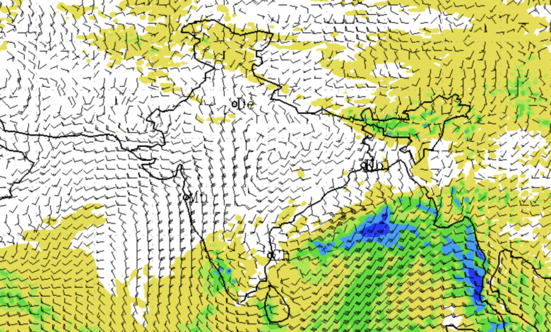
At the same time, the country is witnessing contrasting weather conditions, with heat wave to severe heat wave conditions expected to intensify across northwest and central India over the coming week, while heavy to very heavy rainfall is likely over parts of Northeast India and southern peninsular regions.
Southwest Monsoon 2026: Key Update
| Region | Forecast |
|---|---|
| Kerala | Monsoon onset likely on May 26 |
| South Bay of Bengal | Monsoon advance favourable in next 24 hours |
| Andaman Sea | Conditions favourable for advance |
| Andaman & Nicobar Islands | Monsoon progression expected |
According to IMD, the monsoon circulation has started strengthening under the influence of a well-marked low-pressure area persisting over the southwest and adjoining west-central Bay of Bengal. Associated cyclonic circulations and trough systems are also aiding the seasonal transition.
Heat Wave Intensifies Across India
Large parts of northwest and central India are likely to experience prolonged heat wave conditions during the next several days. Severe heat wave conditions are especially likely over Rajasthan and Uttar Pradesh between May 18 and May 21.
Regions Under Heat Wave Warning
| Region | Heat Wave Period | Severe Heat Wave |
|---|---|---|
| West Rajasthan | May 15–21 | May 18–21 |
| Uttar Pradesh | May 16–21 | May 18–19 |
| Punjab | May 17–21 | Possible isolated pockets |
| Haryana, Chandigarh & Delhi | May 17–21 | Isolated pockets |
| East Rajasthan | May 16–21 | Some areas |
| Madhya Pradesh | May 15–21 | Isolated pockets |
| Vidarbha | May 15–21 | Isolated pockets |
| Chhattisgarh | May 18–21 | Isolated pockets |
| Jharkhand | May 16–18 | — |
The IMD said maximum temperatures across many parts of central India, Gujarat, Rajasthan and adjoining Haryana remained in the range of 40°C to 45°C on May 14. The highest maximum temperature in the country was recorded at Akola in Maharashtra at 45.9°C.
Temperature Highlights
| Location | Maximum Temperature |
|---|---|
| Akola, Maharashtra | 45.9°C |
| Central India | 40–45°C |
| Gujarat | 40–45°C |
| Rajasthan | 40–45°C |
| Adjoining Haryana | 40–45°C |
The weather office has also warned of warm night conditions over Madhya Pradesh and Vidarbha on May 15 and 16.
Heavy Rainfall Forecast for Northeast and South India
While northern and central regions battle extreme heat, northeastern and southern states are likely to witness intense rainfall activity over the coming days.
Northeast India Rainfall Outlook
| State/Region | Forecast |
|---|---|
| Assam & Meghalaya | Heavy rainfall from May 15–21 |
| Arunachal Pradesh | Heavy rainfall May 15–17 and May 20–21 |
| South Assam | Very heavy rainfall on May 15 |
| Nagaland, Manipur, Mizoram | Heavy rainfall on May 15, 20 and 21 |
| Sub-Himalayan West Bengal & Sikkim | Heavy rainfall May 15–18 |
Extremely heavy rainfall was already recorded at isolated places over Assam and Meghalaya during the past 24 hours. B P Ghat in Assam & Meghalaya recorded 27 cm rainfall.
Rainfall Recorded During Last 24 Hours
| Location | Rainfall |
|---|---|
| B P Ghat (Assam & Meghalaya) | 27 cm |
| Bhatkawa (Sub-Himalayan West Bengal) | 11 cm |
| Tuting (Arunachal Pradesh) | 7 cm |
| Ankola (Coastal Karnataka) | 7 cm |
| Aurad (North Interior Karnataka) | 7 cm |
Southern States to Receive Heavy Rain
The IMD has forecast widespread thunderstorms and heavy rainfall over southern peninsular India during the next three to four days.
South India Weather Warning
| Region | Forecast |
|---|---|
| Tamil Nadu, Puducherry & Karaikal | Heavy rainfall May 15–17 |
| Kerala & Mahe | Heavy rain May 16–17 |
| South Interior Karnataka | Heavy rain May 15–18 |
| Lakshadweep | Heavy rain on May 15 |
| Kerala & Mahe | Very heavy rainfall on May 15 |
Hailstorm activity is also likely at isolated places over North Interior Karnataka on May 15.
Thunderstorms, Dust Storms and Gusty Winds
Strong thunderstorm activity accompanied by squally and gusty winds affected several parts of the country during the past 24 hours.
Wind speeds reached 80 kmph at Fatehpur in Rajasthan, while Jaipur recorded gusts of 72 kmph and Bikaner 70 kmph.
Major Wind Gusts Recorded
| Location | Wind Speed |
|---|---|
| Fatehpur, Rajasthan | 80 kmph |
| Jaipur, Rajasthan | 72 kmph |
| Faridkot, Punjab | 72 kmph |
| Bilaspur, Chhattisgarh | 68 kmph |
| Muzaffarnagar, Uttar Pradesh | 63 kmph |
| Karnal, Haryana | 56 kmph |
The IMD has forecast thundersquall activity with wind speeds reaching 50–70 kmph over Punjab, Haryana, Rajasthan, Bihar, Jharkhand, Odisha, Chhattisgarh and Andaman & Nicobar Islands on various days during the week.
Dust storms are also likely over isolated pockets of West Rajasthan on May 15.
Delhi-NCR Weather Forecast
Delhi-NCR is likely to witness hot conditions along with thunderstorms and gusty winds over the next few days.
Delhi Forecast
| Date | Forecast |
|---|---|
| May 15 | Partly cloudy sky, light rain/thunderstorm, winds 40–60 kmph |
| May 16 | Mainly clear sky |
| May 17 | Thundery development likely, gusty winds up to 40 kmph |
| May 18 | Heat intensifies, maximum temperature may touch 44°C |
Maximum temperatures in Delhi are expected to remain between 40°C and 44°C during the forecast period.
Weather Systems Influencing India
Several active weather systems are currently influencing weather conditions across the country:
- A well-marked low-pressure area persists over southwest and adjoining west-central Bay of Bengal.
- A western disturbance remains active over northwestern regions.
- Another cyclonic circulation is present over Jammu and adjoining north Pakistan.
- An upper air cyclonic circulation persists over East Madhya Pradesh.
- An east-west trough extends from West Madhya Pradesh to North Bangladesh.
These systems are expected to continue triggering thunderstorms, rainfall and strong winds over several states.
Fishermen Warning Issued
The IMD has advised fishermen not to venture into several parts of the Bay of Bengal, Andaman Sea and Arabian Sea between May 15 and May 20 due to rough sea conditions and strong winds.
Areas Under Fishermen Warning
| Water Body | Advisory Period |
|---|---|
| South Bay of Bengal | May 15–19 |
| Andaman Sea | May 15–20 |
| Gulf of Mannar | May 15–19 |
| Lakshadweep Area | May 15–16 |
| Karnataka & Kerala Coasts | May 15–16 |
| Southwest Arabian Sea | May 15–20 |
IMD Issues Public Safety Advisory
The weather department has urged people to remain alert during thunderstorms, heat waves and heavy rainfall events.
IMD Safety Measures During Thunderstorms
- Stay indoors and avoid unnecessary travel.
- Do not take shelter under trees.
- Unplug electrical appliances during lightning activity.
- Avoid water bodies.
- Keep away from metal and electrical conductors.
Heat Wave Advisory
- Avoid prolonged exposure to sunlight.
- Drink sufficient water even if not thirsty.
- Use ORS, lemon water, buttermilk and other hydrating fluids.
- Avoid strenuous outdoor activities during peak afternoon hours.
Flood and Heavy Rain Advisory
- Avoid waterlogged areas.
- Follow traffic advisories.
- Stay away from vulnerable structures and landslide-prone zones.
- Farmers have been advised to ensure proper drainage in agricultural fields and protect harvested produce.
Agriculture and Livestock Advisory
The IMD’s agrometeorological division has issued region-specific advisories for farmers across India.
Farmers in Rajasthan, Gujarat, Maharashtra, Madhya Pradesh and Uttar Pradesh have been advised to provide light irrigation to standing crops due to heat wave conditions. In heavy rainfall regions such as Assam, Arunachal Pradesh, Kerala and Sub-Himalayan West Bengal, farmers have been advised to ensure proper drainage and protect crops from waterlogging.
Livestock owners have been advised to keep animals sheltered during thunderstorms and ensure adequate drinking water availability during heat wave conditions.
IMD Warning Categories Explained
| Colour Code | Meaning |
|---|---|
| Green | No warning |
| Yellow | Watch – Be aware |
| Orange | Alert – Be prepared |
| Red | Warning – Take action |
The IMD noted that forecast accuracy decreases with increasing lead period and urged citizens to regularly monitor official weather bulletins and district-wise warnings.