
4,000 Years of Climate History from Majuli Island Offers New Flood Adaptation Insights
A groundbreaking scientific study has reconstructed nearly 4,000 years of climate, vegetation, and flood history of Majuli Island in Assam, providing valuable insights that could help shape future climate adaptation and disaster management strategies in the flood-prone Brahmaputra basin.
Majuli, recognized as the world’s largest inhabited river island, holds immense cultural and ecological significance. Situated between the Brahmaputra River and its tributaries, the island is home to several indigenous communities and serves as a major center of Neo-Vaishnavite culture. However, it has also faced decades of severe riverbank erosion, recurring floods, and land loss.
Researchers from the Birbal Sahni Institute of Palaeosciences (BSIP), Lucknow, an autonomous institute under the Department of Science and Technology (DST), have completed the first comprehensive palaeoecological reconstruction of the island. The study fills a major gap in understanding how climate, vegetation, and river systems have interacted over millennia in the Upper Brahmaputra Valley.
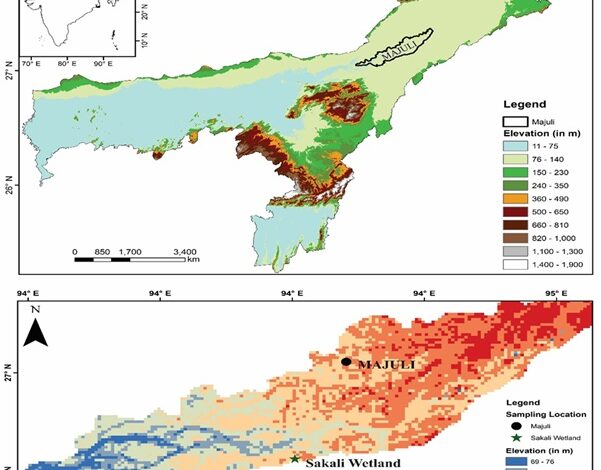
To conduct the research, scientists extracted a 150-centimeter sediment core from the Sakali Wetland on Majuli Island. The sediment layers preserved ancient pollen grains and other environmental indicators that allowed researchers to reconstruct past ecological conditions. Pollen analysis was combined with grain-size studies, enabling scientists to examine both vegetation changes and the intensity of river activity and flooding over time.
The findings reveal that between approximately 4,040 and 2,260 years before present, Majuli experienced a warm and humid climate with dense forest cover. Despite the occurrence of the globally recognized 4.2-kiloyear dry climatic event, the region demonstrated remarkable ecological resilience, maintaining extensive vegetation and relatively stable environmental conditions.
Subsequent centuries witnessed significant fluctuations in monsoon strength and flood dynamics. The study identified alternating periods of stronger and weaker monsoon activity, which influenced vegetation patterns and river behavior across the island. A particularly moist phase occurred between about 1,100 and 500 years ago, corresponding to the Medieval Climatic Anomaly, a period known for relatively warm climatic conditions in many parts of the world.
The research also shows that during the last 500 years, the region experienced declining temperatures and reduced rainfall, consistent with the global climatic phase known as the Little Ice Age. During this period, human influence on the landscape became increasingly evident, accompanied by the spread of more scattered vegetation and changing land-use patterns.

Scientists used modern pollen analogues and a quantitative reconstruction technique known as the Coexistence Approach to estimate historical Mean Annual Temperature (MAT) and Mean Annual Precipitation (MAP). These methods helped establish a detailed timeline of climatic variations and their ecological impacts over four millennia.
An important aspect of the study was its examination of river dynamics. Grain-size analysis revealed a gradual transition from relatively low-energy river conditions to increasingly high-energy fluvial environments. This indicates growing hydrodynamic instability in the region over time, likely contributing to intensified erosion, sediment transport, and flood activity.
The findings underscore the critical role played by the Brahmaputra River and its associated river systems in shaping Majuli’s landscape and ecological evolution. Researchers noted that flood intensity, sediment deposition, and erosion patterns have been closely linked to broader climatic changes, making the island highly sensitive to both regional and global environmental shifts.
The study further highlights a clear connection between local vegetation changes and major global climate events. This demonstrates that ecosystems in the Brahmaputra Valley respond rapidly to wider climate forcing, emphasizing the importance of long-term environmental records for understanding future climate risks.
According to the researchers, the results provide a scientific foundation for biodiversity conservation, wetland restoration, sustainable land-use planning, and improved river management. The integrated approach combining pollen and grain-size data offers a powerful tool for assessing ecological resilience and vulnerability in river island ecosystems.
The research was led by Arya Pandey and Dr. Swati Tripathi of BSIP, in collaboration with scientists from India and Germany. Published in the journal Review of Palaeobotany and Palynology, the study represents the first multi-proxy reconstruction of climate, vegetation, and river processes on Majuli Island.
Experts believe the findings could play a crucial role in informing policymakers, environmental planners, and disaster management authorities as they develop long-term strategies to protect communities facing recurrent flooding, erosion, and climate-related challenges across the Brahmaputra basin.