
Heavy Rainfall, Thunderstorms Likely Across Several Regions; Fresh Western Disturbance to Affect Northwest India
Several parts of India are likely to witness intense weather activity over the coming days as the India Meteorological Department (IMD) has forecast heavy rainfall, thunderstorms, gusty winds and hailstorms in multiple regions. The alert comes amid fluctuating temperature conditions across the country, with heat wave conditions also reported in parts of central India.
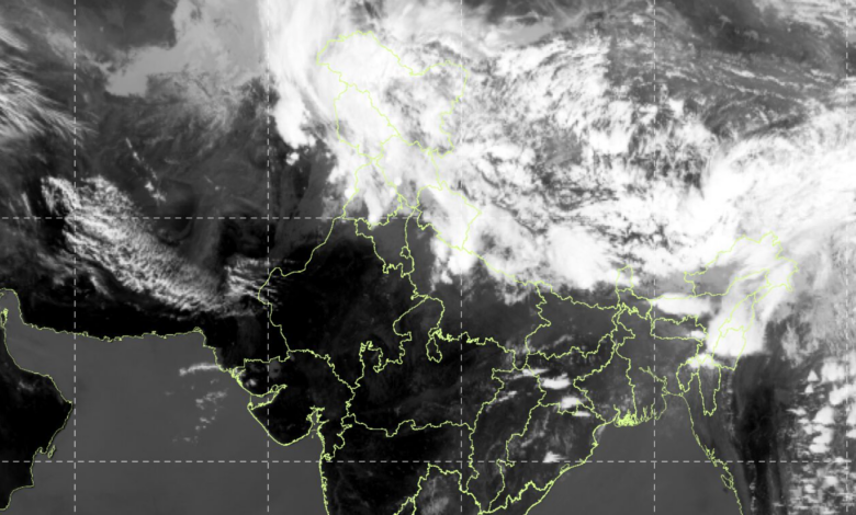
According to the latest weather bulletin, Assam is expected to receive isolated heavy to very heavy rainfall on March 15, followed by heavy rainfall on March 16 and 17. Arunachal Pradesh is also likely to experience isolated heavy rainfall from March 15 to 17, while Mizoram may witness heavy rainfall on March 15. The rainfall activity in Northeast India is likely to be accompanied by thunderstorms, lightning and gusty winds reaching speeds of 30–50 kmph.
Weather officials said that the Western Himalayan Region and adjoining plains will continue to experience thunderstorms, lightning, gusty winds and possible hailstorms on March 15. Another fresh Western Disturbance is expected to affect northwest India from the night of March 17, which may trigger rain, thunderstorms and strong winds across the region from March 18 onwards.
Weather During the Last 24 Hours
During the past 24 hours ending at 8:30 AM on March 15, several regions recorded significant weather events. Heat wave conditions prevailed at isolated places in Vidarbha and northwest Odisha, while heavy to very heavy rainfall between 7 and 20 cm was recorded in parts of Assam.
Heavy rainfall ranging between 7 and 11 cm was also recorded in isolated places in Arunachal Pradesh, while hailstorms were reported in parts of Assam and Mizoram.
Temperature Conditions Across the Country
Maximum temperatures during the past 24 hours ranged between 38°C and 41°C in several pockets of southwest Rajasthan, north Gujarat, north interior Maharashtra, southwest Madhya Pradesh, south Chhattisgarh and parts of Telangana, Rayalaseema and Tamil Nadu. Many other regions recorded temperatures between 35°C and 38°C.
The highest maximum temperature in the country was recorded at Akola in Vidarbha at 41.6°C, indicating unusually high heat conditions for this time of year.
Meteorologists noted that maximum temperatures remained markedly above normal by more than 5°C in several regions, including parts of Himachal Pradesh, Uttarakhand, Jammu and Kashmir, Gangetic West Bengal, northern Odisha, Jharkhand and Vidarbha.
Minimum temperatures across northern and central India were recorded between 14°C and 18°C, while most other plains experienced night temperatures between 18°C and 22°C. The lowest minimum temperature in the plains was recorded at Alwar in Rajasthan at 10.3°C.
Weather Systems Influencing Conditions
The current weather pattern is being driven by multiple atmospheric systems. A Western Disturbance in the form of an upper-air cyclonic circulation is currently located over north Punjab and adjoining areas, influencing weather across northwest India.
Another upper-air cyclonic circulation is present over northeast Assam, contributing to the heavy rainfall activity in the Northeast. In addition, a trough extending from Marathwada to north interior Tamil Nadu and another trough stretching from the southwest Bay of Bengal toward the Comorin region are also affecting weather patterns in southern and central parts of the country.
Meteorologists also reported that a subtropical westerly jet stream with wind speeds of around 115 knots at an altitude of 12.6 km above sea level is prevailing over west India, further intensifying weather disturbances.
Thunderstorm and Hailstorm Warnings
Several states have been placed under thunderstorm alerts in the coming days. Strong winds with speeds reaching 40–50 kmph and gusting up to 60 kmph are expected in parts of Jammu and Kashmir, Himachal Pradesh, Uttarakhand, Punjab, Haryana, Delhi and Uttar Pradesh.
Some areas, particularly Uttarakhand, Gangetic West Bengal, Jharkhand and Odisha, may experience squally winds reaching 50–60 kmph with gusts up to 70 kmph, accompanied by hailstorms.
Thunderstorm activity is also expected across east and central India between March 16 and 19, with the peak intensity likely on March 16.
Rainfall Forecast by Region
Rainfall activity is expected across several parts of the country in the coming days.
| Region | Forecast |
|---|---|
| Northeast India | Widespread rain and thunderstorms for next 5–6 days |
| Western Himalayan Region | Light to moderate rain or snowfall from March 15–21 |
| East & Central India | Thunderstorms and gusty winds from March 15–19 |
| South India | Scattered rain with thunderstorms in Telangana, Andhra Pradesh and Karnataka |
| West India | Isolated thunderstorms and rain until March 19 |
Weather Outlook for Delhi-NCR
For Delhi-NCR, the IMD has forecast generally cloudy skies with light rain and thunderstorms on March 15, accompanied by gusty winds reaching 30–40 kmph with gusts up to 50 kmph. The maximum temperature is expected to remain between 28°C and 30°C.
On March 16 and 17, partly cloudy conditions with strong daytime winds are expected, while light rain and thunderstorms may return on March 18.
Possible Impact
Meteorologists have warned that thunderstorms and strong winds may cause damage to standing crops, uprooting of trees, and disruptions to power and communication lines. Hailstorms could also harm horticultural crops and pose risks to people and livestock in open areas.
Authorities have advised residents to stay indoors during thunderstorms, avoid taking shelter under trees and secure loose objects. People have also been urged to monitor weather updates closely and follow local advisories to minimize risks.