Severe Cyclonic Storm Akvan to Make Landfall Near Gopalpur Around Noon Today
IMD warns of heavy rainfall, strong winds and storm surge along north Andhra Pradesh and south Odisha coasts; flash flood risk likely in several districts

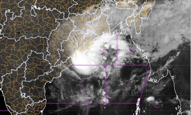
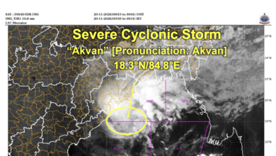
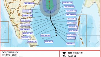
Severe Cyclonic Storm Akvan over the westcentral Bay of Bengal is moving towards the north Andhra Pradesh and south Odisha coasts and is expected to make landfall close to Gopalpur around noon on Friday, November 20, according to the India Meteorological Department (IMD).
In its third hourly update issued at 2:40 am IST on Friday, the IMD reported that the cyclone was centred over the westcentral Bay of Bengal near latitude 17.35°N and longitude 85.00°E at 1:30 am. The system had moved north-northwestwards at a speed of approximately 17 kmph during the preceding six hours.
At the time of observation, the cyclone was located approximately 140 km southeast of Kalingapatnam in Andhra Pradesh, 180 km east-southeast of Visakhapatnam, 210 km south of Gopalpur in Odisha and 290 km south-southwest of Puri. It was also situated around 370 km east-northeast of Narsapur in Andhra Pradesh.
Wind speed to reach 90 kmph during landfall
The severe cyclonic storm was generating maximum sustained winds of 85–95 kmph near its centre, with gusts reaching 105 kmph.
According to the IMD forecast, Akvan is expected to cross the north Andhra Pradesh and south Odisha coasts close to Gopalpur around noon on November 20. During landfall, the wind speed is likely to remain around 70–80 kmph, with gusts reaching up to 90 kmph.
The coastal districts of Andhra Pradesh and Odisha are likely to experience strong winds, heavy rainfall and rough sea conditions as the cyclone approaches the coastline.
Storm surge warning for coastal districts
The IMD has warned of a storm surge of approximately 0.5 metres above the astronomical tide during landfall. The surge is likely to inundate low-lying coastal areas of north coastal Andhra Pradesh and south coastal Odisha.
In Andhra Pradesh, the districts of Vizianagaram and Srikakulam are likely to be affected, while Ganjam and Puri districts in Odisha may also experience coastal inundation.
Residents in vulnerable coastal and low-lying areas have been advised to remain alert and follow instructions issued by local authorities.
Heavy rainfall recorded across Odisha and Andhra Pradesh
Rainfall observations received between 8:30 am on November 19 and 12:30 am on November 20 indicate that several coastal locations have already received significant precipitation under the influence of the cyclone.
Chandbali recorded 56 mm of rainfall, while Paradip received 68 mm. Gopalpur recorded 66 mm, Puri received 26 mm and Tuni in Andhra Pradesh reported 13.4 mm during the observation period.
The IMD is monitoring the cyclone through satellite imagery from INSAT-3DR and Doppler Weather Radar observations from Visakhapatnam and Gopalpur.
Flash flood risk in Odisha, West Bengal and Andhra Pradesh
Apart from coastal inundation, the IMD has highlighted the possibility of flash floods in several districts due to anticipated rainfall over the next 24 hours.
Moderate to high flash flood risk has been forecast over selected watersheds and neighbourhoods in Odisha, Gangetic West Bengal and Coastal Andhra Pradesh.
In Odisha, the districts identified include Baleshwar, Mayurbhanj, Keonjhar, Deogarh, Ganjam, Gajapati and Sundargarh.
In Gangetic West Bengal, the areas under the flash flood risk warning include East Midnapore, West Midnapore, Howrah, Hooghly, North 24 Parganas, Purulia, Bankura, South 24 Parganas and Nadia.
In Coastal Andhra Pradesh and Yanam, Srikakulam district has been identified as an area of concern.
The IMD has cautioned that surface runoff and localised inundation may occur in areas where the soil is already saturated, particularly in low-lying locations and vulnerable watersheds.
Authorities monitoring cyclone movement
With Akvan approaching the coastline, coastal communities in north Andhra Pradesh and south Odisha remain under close observation. The expected combination of strong winds, rainfall, storm surge and possible flash flooding could affect normal life in vulnerable coastal and inland areas.
The cyclone’s movement and intensity are being closely monitored through Doppler weather radar, satellite observations and other meteorological forecasting systems.
The IMD’s latest forecast indicates that the critical phase will be the system’s approach and landfall near Gopalpur around noon on Friday. Residents in the affected districts are advised to follow official weather bulletins and evacuation or safety instructions issued by the administration.