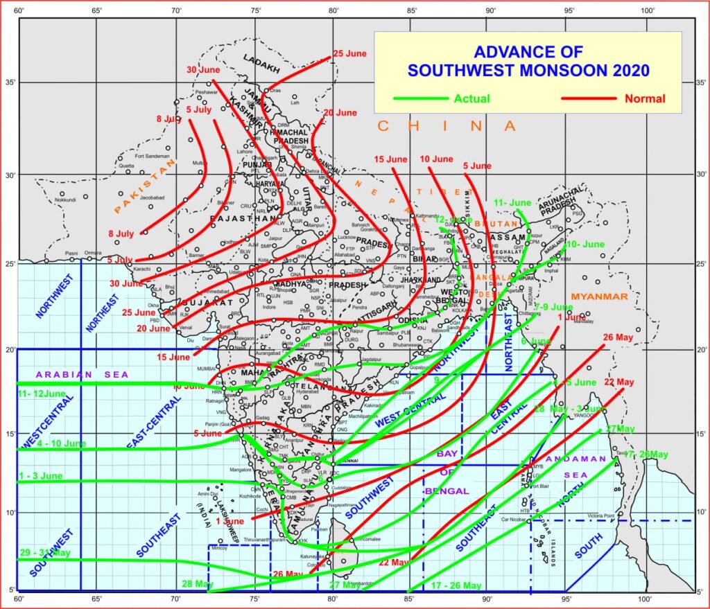
Monsoon advances into Maharashtra, Telangana, Chhattisgarh, Arunachal Pradesh, Assam, Meghalaya, Odisha, Sikkim & West Bengal
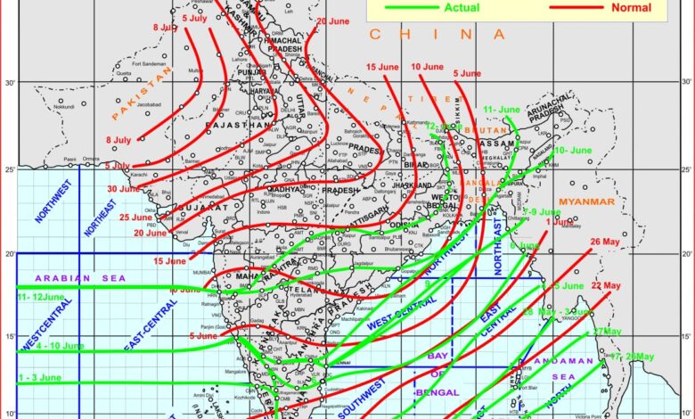
Southwest Monsoon has further advanced into some more parts Madhya Maharashtra & Marathwada, remaining parts of Telangana, some parts of Vidarbha, some more parts of Chhattisgarh, remaining parts of Bay of Bengal, Arunachal Pradesh and Assam & Meghalaya, most parts of Odisha & West Bengal and entire Sikkim. With the strengthening of the low level southwesterly flow along the west Peninsular coast of India isolated heavy to very heavy rainfall is likely over Coastal Karnataka during next 2 days.
Conditions are becoming favourable for further advance of Southwest Monsoon into some more parts of Central Arabian Sea, remaining parts of Maharashtra (including Mumbai), Odisha and West Bengal, some more parts of Chhattisgarh and some parts of south Gujarat State, south Madhya Pradesh, Jharkhand & Bihar during next 48 hours.
The low pressure area over north Coastal Andhra Pradesh and adjoining Coastal Odisha & neighbourhood with associated cyclonic circulation extending upto 7.6 km above mean sea level, tilting southwestwards with height persists.
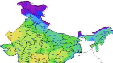
Under the influence of this Low Pressure Area, scattered heavy to very heavy with isolated extremely heavy rainfall likely over Konkan & Goa and Isolated heavy to very heavy rainfall over Madhya Maharashtra, Marathawada, Coastal Andhra Pradesh & Yanam, North Interior Karnataka, Chhattisgarh, Telangana, Vidarbha, Assam & Meghalaya during next 24 hours; scattered heavy to very heavy with isolated extremely heavy rainfall likely over Vidarbha and Isolated heavy to very heavy rainfall over Coastal Karnataka, Madhya Maharashtra, Chhattisgarh, Telangana, Assam & Meghalaya during subsequent 24 hours.
