Intense rainfall spell over northeast and adjoining east India during 9th to 12th July, 2020
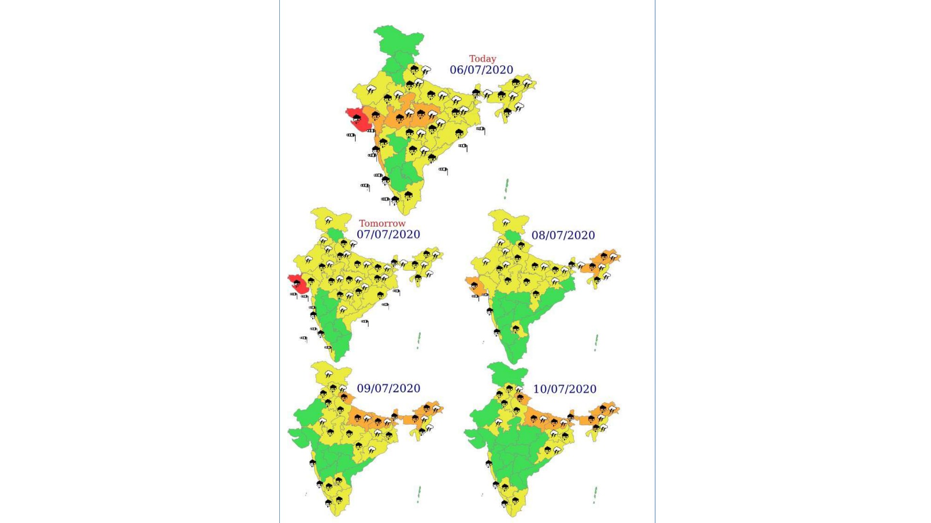
The monsoon trough at mean sea level lies to south of its normal position. It is very likely to shift northwards towards the foothills of Himalayas from 09th July onwards.
High Convergence of southwesterly/southerly winds from Bay of Bengal at lower tropospheric levels very likely over northeast & east India from 09th July onwards.
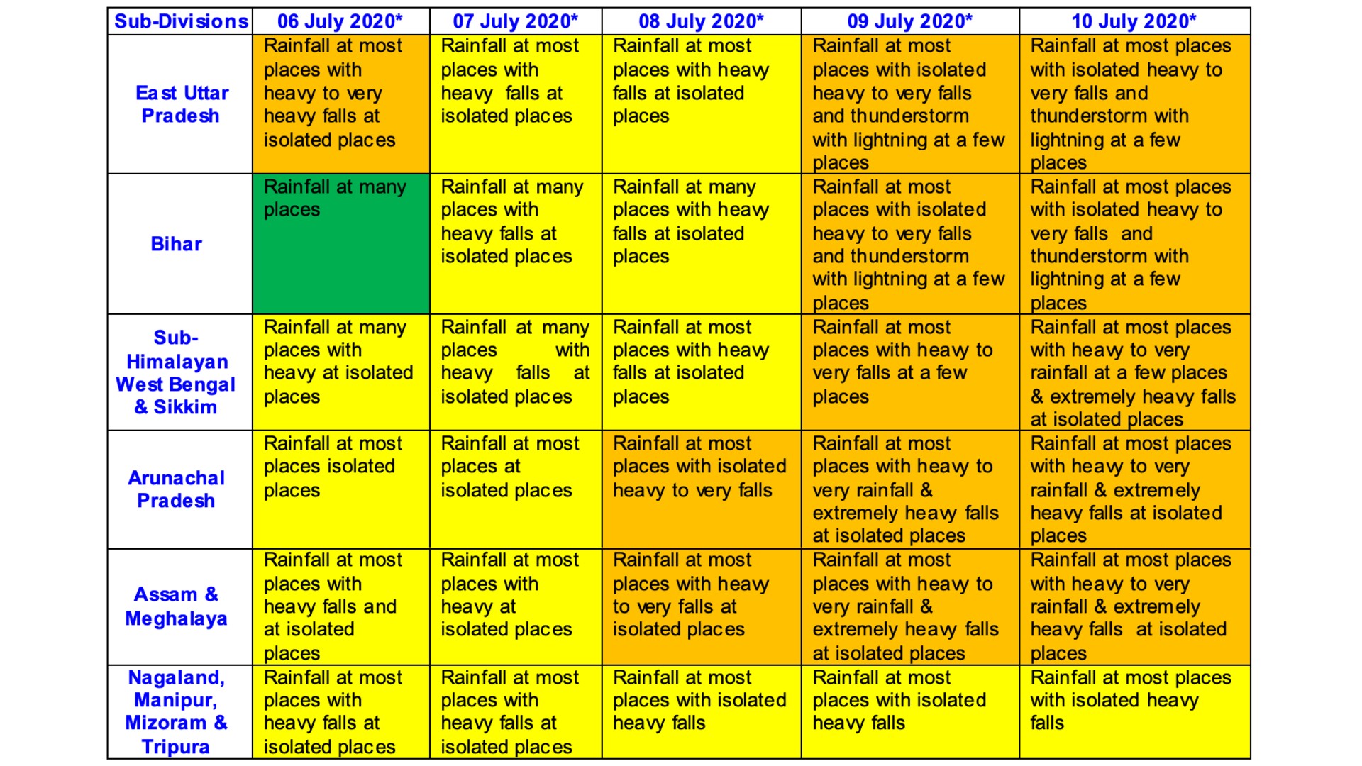
Under its influence, widespread rainfall with isolated heavy to very heavy falls very likely over Assam & Meghalaya, Arunachal Pradesh, Sub-Himalayan West Bengal, Sikkim, Bihar and East Uttar Pradesh on 09th & 10th July, 2020. Isolated extremely heavy falls (≥ 20 cm) are also very likely over Arunachal Pradesh, Assam & Meghalaya and Sub-Himalayan West Bengal & Sikkim during 09th to 12th July, 2020.
Isolated heavy rainfall likely to occur over Nagaland, Manipur, Mizoram & Tripura during 09th to 12th July, 2020. Detailed forecast & warnings for next 5 days are as follow:
