A Western Disturbance as a cyclonic circulation lies over Iran & neighbourhood at mid-tropospheric levels. Under its influence, an induced cyclonic circulation very likely to form over southwest Rajasthan & adjoining Pakistan at lower tropospheric levels by tomorrow, the 04th March, 2020 night.

High moisture feeding very likely to take place over northwest India from Arabian Sea at lower & mid tropospheric levels mainly on 5th & 6th March, 2020. Under its influence:
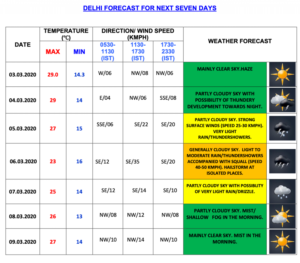
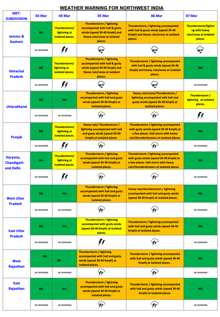
Widespread rainfall/snowfall is most likely to occur over Western Himalayan region during 05th to 07th March, 2020. Fairly widespread to widespread rainfall very likely over Punjab, Haryana, Chandigarh, Delhi and Uttar Pradesh during the same period.
Thunderstorm accompanied with lightning, hail & gusty wind (speed reaching 30-40 kmph) is very likely to occur at isolated places over Jammu & Kashmir, Ladakh, Gilgit-Baltistan, Himachal Pradesh, Uttarakhand, Uttar Pradesh, north Rajasthan and at a few places over Punjab & Haryana on 05th & 06th March, 2020.
Heavy Rain/snowfall also very likely over Jammu & Kashmir, Gilgit-Baltistan from 05th to 07th and over Himachal Pradesh on 5th & 6th and over Uttarakhand on 06th March 2020; heavy rainfall at isolated places over Punjab on 05th & 6th; over Haryana, Chandigarh and West Uttar Pradesh on 06th March, 2020.
Due to most likely confluence between westerly winds associated with the Western Disturbance and moist low level easterly wind from Arabian Sea mainly during 04th- 06th March over Central & adjoining East India, moderate scattered to fairly widespread rainfall with isolated thunderstorm accompanied with lightning/hail very likely over Odisha, West Bengal & Sikkim, Bihar, Jharkhand, Chhattisgarh, Madhya Pradesh and Northeastern states during same period.