Heat Wave Conditions Grip Parts of India; Rain and Snowfall Likely in Himalayan Region: IMD
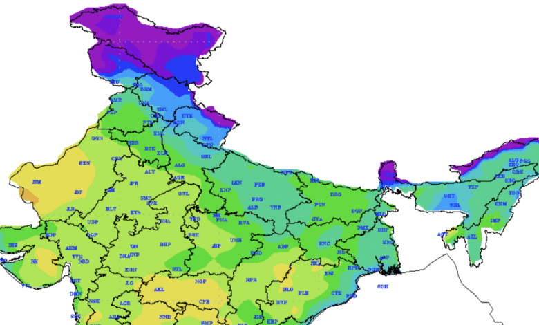
The India Meteorological Department has forecast unusually high temperatures across several parts of the country, particularly in the Western Himalayan Region, where maximum temperatures are expected to remain 8–10°C above normal for the next four days before gradually declining.
According to the latest weather bulletin issued on March 6, 2026, parts of northwest India and adjoining central regions are also likely to witness above-normal temperatures during the coming week. The plains of northwest India may see temperatures 5–7°C above normal, while parts of central India may experience deviations of 4–6°C above the seasonal average.
Weather Conditions in the Last 24 Hours
The meteorological department reported dense to very dense fog in isolated pockets of Odisha, with visibility dropping to 40 metres at Chandbali. At the same time, heat wave conditions were recorded in parts of Konkan, while hot and humid weather prevailed along coastal areas of Saurashtra and north Gujarat.
Temperatures across many regions remained unusually high for early March. Several locations in Maharashtra, Andhra Pradesh, and Rajasthan recorded maximum temperatures between 37°C and 40°C.
The highest maximum temperature of 39.6°C was recorded at Jharsuguda in Odisha, making it one of the hottest places in the country during the past 24 hours.
Temperature Summary (Past 24 Hours)
| Region | Temperature Range |
|---|---|
| Maharashtra, Andhra Pradesh | 37°C – 40°C |
| Rajasthan, Saurashtra & Kutch | 37°C – 40°C |
| Madhya Pradesh, Telangana, Chhattisgarh | Around 36°C – 39°C |
| Northern Plains | 33°C – 36°C |
Meanwhile, minimum temperatures across most northern and central states ranged between 14°C and 18°C, with the lowest minimum temperature recorded at 10.6°C in Fatehpur, Rajasthan.
Rain and Snowfall Forecast
The IMD has predicted light rainfall and snowfall in parts of the Himalayan region between March 7 and March 12 under the influence of weak western disturbances.
Affected regions include:
- Jammu and Kashmir
- Himachal Pradesh
- Uttarakhand
Additionally, thunderstorms accompanied by lightning and gusty winds reaching 40–50 kmph are expected in parts of eastern India.
Thunderstorm and Rainfall Warning
| Region | Expected Weather | Dates |
|---|---|---|
| Odisha | Rain with thunderstorm and gusty winds (40–50 kmph) | March 7–9 |
| Sub-Himalayan West Bengal & Sikkim | Rain and gusty winds | March 8–10 |
| Jharkhand | Rain and thunderstorms | March 8–9 |
| Bihar | Rain and thunderstorms | March 9–11 |
| Northeast India | Thunderstorms and rainfall | March 9–12 |
Heat Wave Warning
The IMD has also issued heat wave alerts for several regions during the coming days.
| Region | Heat Wave Period |
|---|---|
| Himachal Pradesh | March 6–7 |
| West Rajasthan | March 9–10 |
| Saurashtra & Kutch | March 6–10 |
| Gujarat Region | March 8–10 |
Hot and humid conditions are also likely in coastal areas including Odisha, Konkan, Coastal Andhra Pradesh and North Coastal Tamil Nadu.
Weather Forecast for Delhi–NCR
The national capital region, including Delhi, is expected to witness clear skies and above-normal temperatures during the next few days.
| Date | Maximum Temp | Minimum Temp | Weather |
|---|---|---|---|
| March 6 | 33°C – 35°C | 16°C – 18°C | Clear sky |
| March 7 | 33°C – 35°C | 16°C – 18°C | Clear sky |
| March 8 | 33°C – 35°C | 16°C – 18°C | Clear sky |
| March 9 | 33°C – 35°C | 16°C – 18°C | Clear sky |
The IMD said both maximum and minimum temperatures in Delhi are significantly above normal, with daytime temperatures exceeding the seasonal average by more than 5°C.
Advisory for Farmers
Due to the rising temperatures, the meteorological department has issued agrometeorological advisories for farmers across several states. Farmers have been advised to provide light and frequent irrigation to crops such as wheat, mustard, chickpea and vegetables to prevent heat stress.
Agricultural experts also recommended maintaining soil moisture and protecting crops during peak daytime heat.
The IMD continues to monitor evolving weather systems, including multiple western disturbances and upper air cyclonic circulations, which may influence rainfall and temperature patterns across the country in the coming days.