


Ancient lake sediment records retrieved from the Indus River valley in Ladakh have provided valuable insights into climate variations between 19.6 and 6.1 thousand years ago. These findings shed light on the climate during the last deglaciation period and contribute to our understanding of climate variation during that era.
Researchers have meticulously reconstructed climate records spanning from millennia to centuries by analyzing paleolake deposits. They have identified distinct climate phases, including a cold arid period, a strong monsoon period, and a subsequent weakening monsoon phase accompanied by intensified El Nino activities during the Last Glacial Maxima.

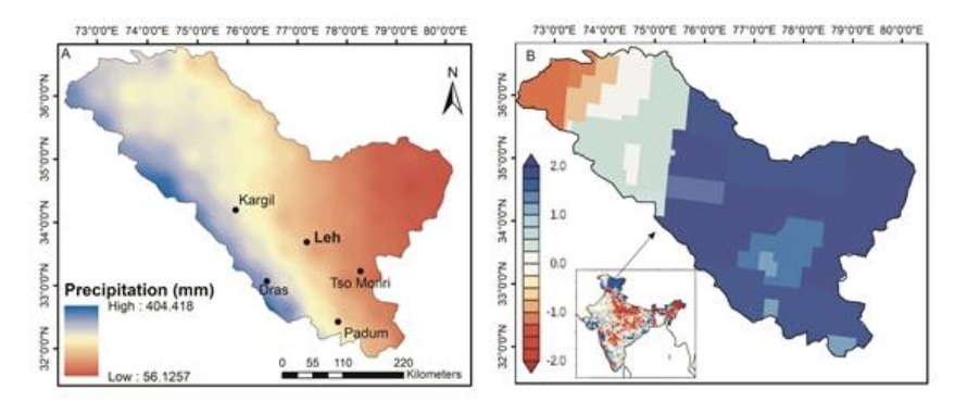
The Ladakh region, situated in the Trans-Himalaya, serves as an environmental boundary between North Atlantic and monsoon forcings. Its unique location offers valuable insights into atmospheric circulations, such as westerly winds and the Indian summer monsoon. Understanding the variability of these atmospheric circulations is crucial, especially in the context of global warming. The region boasts numerous sedimentary archives that can be leveraged to extract information about past climates, with lake deposits being particularly useful due to their continuous sedimentation rate and ability to document short and long-term climate changes. However, previous studies in the Ladakh region have predominantly focused on the Holocene period, leaving older periods less explored.
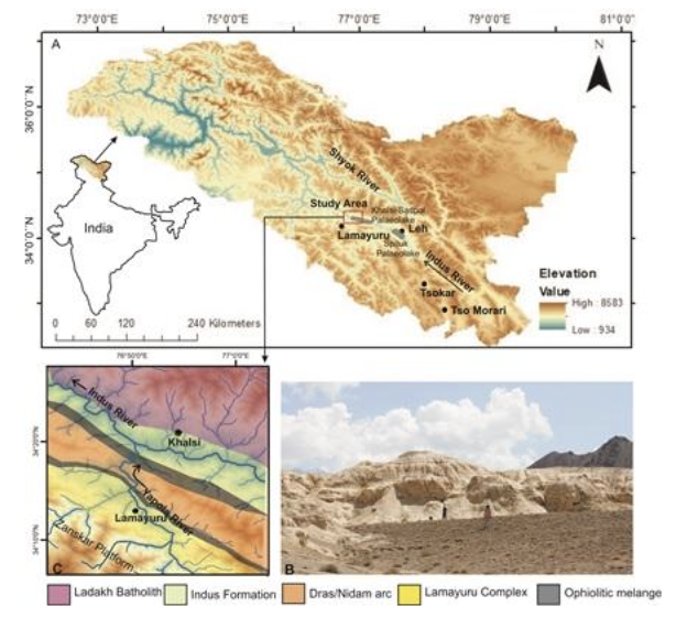
Recognizing the abundance of well-preserved ancient lake deposits along the Indus River, scientists from the Birbal Sahni Institute of Palaeosciences (BSIP), an autonomous institute under the Department of Science and Technology, undertook extensive sampling and laboratory analysis of sediments from an 18-meter thick sediment sequence located at an altitude of 3287 meters. By examining physical characteristics such as color, texture, grain size, composition, total organic carbon, and magnetic parameters of the sediments, they were able to reconstruct climate variations during the studied period.
The researchers observed that a cold arid climate influenced by westerly circulation prevailed from 19.6 to 11.1 thousand years ago. Subsequently, from 11.1 to 7.5 thousand years ago, monsoon forcings played a dominant role in shaping the region’s climate. The transition to orbitally controlled solar insolation then influenced the position of the Inter Tropical Convergence Zone (ITCZ) and became the key driver of atmospheric circulations. Within the dominant westerly period, a short wet phase from around 17.4 to 16.5 thousand years ago, known as the early wet phase of the two-fold H1 event, was identified. Westerlies regained strength from 7.5 to 6.1 thousand years ago during the mid-Holocene, coinciding with decreasing insolation, a weakening monsoon, and intensified El Nino activities.
The shift from glacial to interglacial climate triggers significant climate reorganization on a large scale. Therefore, understanding the glacial-to-interglacial transitional period is crucial for comprehending climate evolution. Mountainous regions, given their unique geomorphological characteristics, are particularly vulnerable to these changes. Thus, gaining a clearer understanding of hydroclimate changes during the transition from colder to warmer conditions is essential.
The study, published in the journal PALAEO3, provides valuable insights into past climate variations since the last deglaciation, subsequent to the Last Glacial Maxima. It also contributes to recognizing the influence of different forcing mechanisms and teleconnections, enhancing our understanding of climate variability during this dynamic transitional phase, as well as the evolution of the Indian Summer Monsoon (ISM) and westerly winds during the deglaciation period.