Southwest Monsoon Withdraws from Parts of Southwest Rajasthan, Low Pressure Area Expected in Andaman Sea

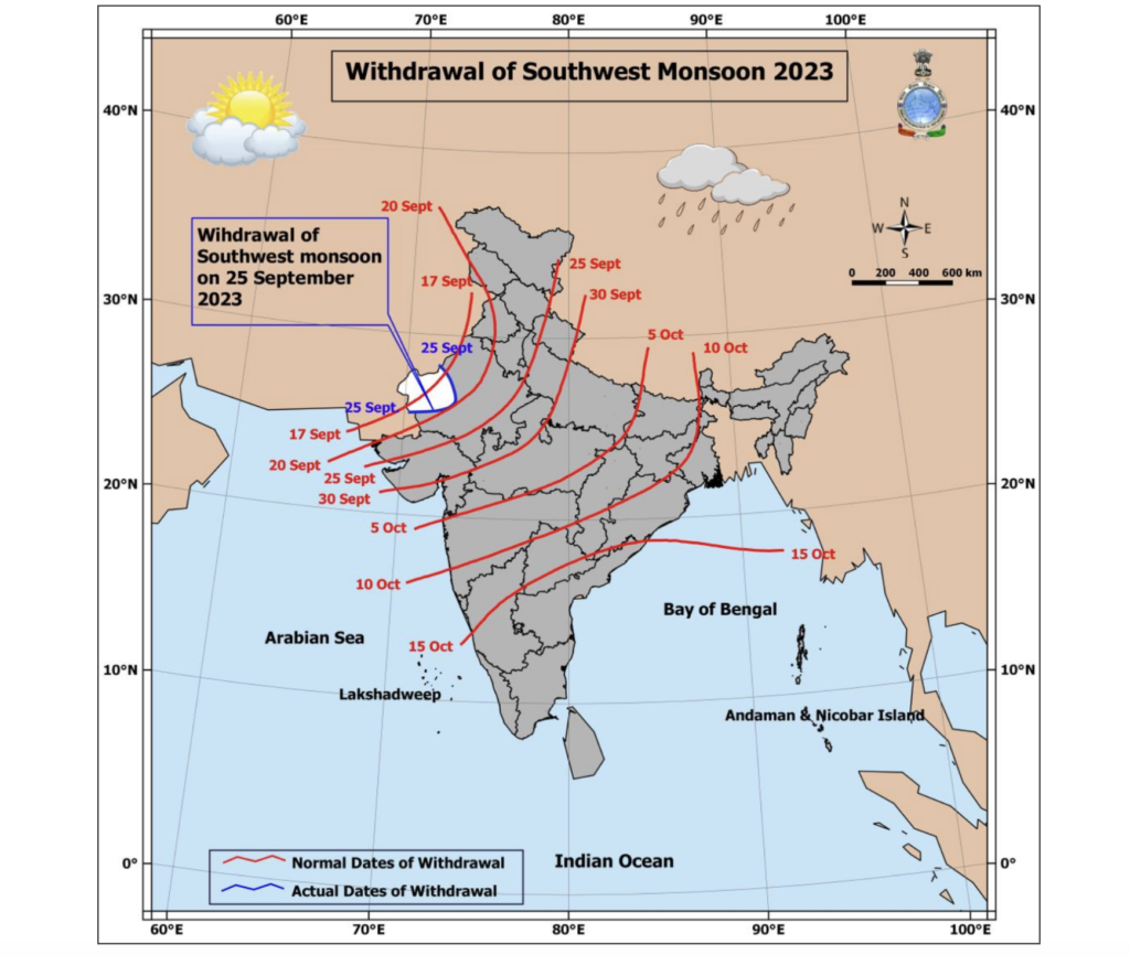
New Delhi, September 25, 2023 – The India Meteorological Department (IMD) has announced the withdrawal of the Southwest Monsoon from parts of southwest Rajasthan today, on the 25th of September, 2023, against its normal withdrawal date of the 17th of September. The decision to withdraw the Southwest Monsoon is based on specific meteorological conditions, including the presence of an anti-cyclonic circulation at the 850 hPa level, a lack of rainfall for the past five days, and dry weather conditions indicated by water vapor imagery over the region. The withdrawal line of the Southwest Monsoon passes through 28.3°N/72.0°E, traversing Nokhra, Jodhpur, Barmer, and 25.7°N/70.3°E.
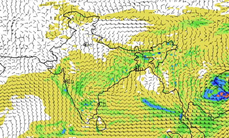
Additionally, the IMD has forecasted the formation of a Low-Pressure Area over the north Andaman Sea and adjoining East-central Bay of Bengal around the 30th of September, 2023. Subsequently, this system is expected to move west-northwestwards with the possibility of gradual intensification.
Weather Observations in the Past 24 Hours:
- Heavy to very heavy rainfall occurred at isolated places over Gujarat Region, West Madhya Pradesh, Sub-Himalaya West Bengal & Sikkim, Tamil Nadu, and heavy rainfall was recorded at isolated places over Rajasthan, Bihar, Saurashtra, Rayalaseema, Telangana, Coastal Andhra Pradesh, Arunachal Pradesh, Assam & Meghalaya.
Significant Weather Features:
- A cyclonic circulation is situated over Southeast Uttar Pradesh and its surrounding regions, with a trough extending from this system to West Assam in lower tropospheric levels.
- Another cyclonic circulation is present over south Chhattisgarh, and a trough extends from this cyclonic circulation to south Konkan in middle tropospheric levels.
- The formation of a cyclonic circulation is anticipated over the north Andaman Sea and its surrounding areas around the 29th of September. Under its influence, a Low-Pressure Area is expected to develop over the north Andaman Sea and adjoining East-central Bay of Bengal in the subsequent 24 hours. Following this, the system is likely to move west-northwestwards with the potential for gradual intensification.
Weather Forecast and Warnings:
- East India: Bihar is likely to experience light/moderate fairly widespread to widespread rainfall/thunderstorms, with isolated heavy rainfall on the 25th of September. Andaman & Nicobar Islands are expected to witness isolated very heavy rainfall during the 27th-29th of September.
- South India: Coastal Andhra Pradesh, Telangana, and Tamil Nadu are likely to experience light/moderate fairly widespread to widespread rainfall, with isolated heavy rainfall on various dates. Coastal Karnataka, Kerala, North Interior Karnataka, Rayalaseema, and South Interior Karnataka may also see similar weather patterns.
- West India: Konkan & Goa, Madhya Maharashtra, Marathwada, Gujarat Region, and Saurashtra may experience light/moderate fairly widespread to widespread rainfall/thunderstorms, with isolated heavy rainfall on different dates.
- Northeast India: Light/moderate fairly widespread rainfall/thunderstorms with isolated heavy rainfall activity are expected over Arunachal Pradesh, Assam & Meghalaya on the 25th of September.
- Central India: Vidarbha and Chhattisgarh may witness light/moderate fairly widespread to widespread rainfall/thunderstorms with isolated heavy rainfall on the 25th of September.
For more detailed forecasts and updates, please refer to the IMD website.
Impact and Action Suggested: Due to the forecast of very heavy rainfall over Andaman & Nicobar Islands during the 27th-29th of September, the IMD has issued advisories for potential localized flooding, water logging, and disruptions to traffic. Travelers are advised to check for traffic congestion on their routes before departing and follow any traffic advisories issued. It’s also recommended to avoid areas prone to water logging and stay away from vulnerable structures.


